Friday, September 18, 2009

Swiss Glacier Days


After spending much of the past two weeks trying to stay out of crevasses as I climbed the two highest mountains in Western Europe, I now found myself deep within a glacier, for two days in a row. The blue ice, the penetrating cold, and the noise of dripping water and creaking as it ground its way downhill will forever remain in my mind. But before I tell you the story of how I ended up in a glacier let me back up a little.

I left Zermatt still a little torn over my decision to leave the Matterhorn for another day, but I know in my heart that I made the right call. I caught the train down the valley and headed off to Brigerbad – a huge thermal pool complex.


After two long hard days of climbing soaking in the hot water was bliss. Although, I decided to be a kid and also rode the water slides – they were among the fastest hydro-slides I've ever been on. Another really neat part of the complex was a pool called the "grotto". You can see a picture of this on the far left of my photo of their entrance sign. The grotto was like an artificial cave with the hot water flooding up through the floor. The overall setting of the pools literally surrounding by mountains was amazing.

Then onto Brig – a city of 12,000 sitting beside the Rhône and Saltine Rivers. In fact, the name Brig comes from the word 'bridge'. It also sits at the base of the Swiss side of the Simplon Pass that crosses over the Alps to Italy. I drove by a really interesting building (I was too long soaking in the hot pools to pay it a visit) that my guide book said was the Stockalperschloss. Apparently, a guy by the name of Kaspar von Stockalper (born 1609 – died 1691) got super rich by dominating the Simplon Pass trade routes. He had a palace built for himself in 1651-61. It is somewhat unique in its architectural style with the three towers and their onion-like domes. It is now owned by the city and houses a museum.


The Stockalperschloss in Brig.

I visited the local supermarket just before closing time then drove up into the hills seeking a camping site. I followed steep and twisty roads that must have been the old highway before the new tunnel was built through the mountain in the 1960s. There were many "Camping Verboten" (i.e., no camping allowed) signs so I thought my tent on the ridge beside the road would be too conspicuous. So, stealth camping took a new turn as I pulled the car off the road to create an area between the car and the metal crash-barrier. I fired up another of these portable BBQs and had a feast of different types of sausages (one of my favorite meals). My guide book said this area of Switzerland is famous for hunting during the autumn/fall and that you should capitalize on opportunities to try the local game meats. Therefore, I was delighted to find wild boar and deer sausages (the meats mixed into a single sausage) at the supermarket. I had to laugh out loud though when opening the packet I saw that the wild boar was 5% and the deer 38% with the rest being beef. And about the local flavor, well the package said that the deer was farm raised from New Zealand.


Sunset from my sausage BBQ location above Brig.


But the views more than made up for any sausage disappointment (they were still excellent by the way). Watching the sun set over down the Rhône Valley while the shadows crept up the surrounding peaks was a real treat.


 Close up view of the last light – no filter on my camera by must be a lot of haze for this bright orange color.


Hardly any cars came by in the night which meant I had a good sleep, just using a ground sheet, inflatable mat, and sleeping bag. I do have to put in a plug for the sleeping mat I am using. It is the ExPed by Outdoor Research. It is inflatable with a bizarre hand pump (but about ten pumps and you are done) and contains down feathers for warmth. Best sleeping mat I have ever used.


Sunrise over my bivy spot beside the road.

Well rested I returned to the valley and followed the Rhône towards its source. I drove through a string of villages (collectively known as the Goms) that all had beautiful geranium-bedecked timber chalets and onion-domed churches. One of these towns was called Lax.


The local tourism board markets this town with the slogan: (Re)Lax. Not quite sure how you go about promoting one of the other towns I drove through along this same valley.


 The guidebook suggested taking a cable car ride (well actually two) from the town of Fiech. I have been amazed at the sheer number of these incredible engineering marvels as I have traveled through the Alps. Both the French term téléphérique and German seilbahn are the more common names in Europe. These are different systems than the gondola systems found on North America ski resorts as there are only two cars – one coming up and one down which you pass in the middle.


Leaving the quaint village at 1050 meters (3,445 feet) above sea level we travelled (about 50 hikers, climbers, but mostly day trippers going to look at the view) jammed standing up in the car to an intermediate station. Then onto the second line emerging at 2,926 meters (9,600 feet) at a peak called Eggishorn where the view down to the Aletch Glacier is simply incredible. Be sure to click on the Eggishorn link and check out the panorama link. The site of a 23 km (14 mile) long glacier curving beneath your feet is hard to comprehend. This is the largest glacier in Europe and it covers more than 120 square kilometers (more than 45 square miles). A couple of photos trying out wide angle view feature on my camera – one looking north towards the famous peaks of Jungfrau and Mönch at the glacier headwaters and the Aletschorn (4,195 meters/13,763 feet) right across from where I'm standing. The second photo is looking downstream towards the terminal. Almost all the area captured in my photos is covered in the UNESCO World Heritage site.


I did a really enjoyable hike/scramble to a rocky peak to eat a picnic lunch with one of the most amazing views I've ever experienced. The excellent interpretive display panels had pictures that clearly showed how this glacier has receded – a trend I would see repeated. Check out this great website where you can see for yourself the change in the Aletschgletscher (Aletsch Glacier) in just over one hundred years.

Back down and back on the road as I continued up the valley. A quick but interesting stop at a tiny village called Niederwald (only about 20 chalets), hometown of Cäsar Ritz (born 1850 – died 1918), founder of the luxury hotel chain. He and his wife were buried in the church cemetery that had interesting wooden carved tombstones.


Tomb markers, including the Ritz's, in Niederwald.

Reaching the town of Ulrichen I turned east and began the steady and steep climb up to the town of Gletsch and then up the switchbacks to Furka Pass.


The Furka Pass road.

I didn't go all the way to the summit but stopped at the large building, a hotel, on the left side of this photo. I parked here and paid my 5 Euro fee for an opportunity to be inside a glacier. The Rhonegletscher (Rhone Glacier) is located here. It is fascinating to visit for a number of reasons. Firstly, this is the source of one of Europe's great rivers. Secondly, every spring for the past 100 years the owners of the hotel have hired miners who dig a tunnel into the glacier and it becomes a major tourist attraction. Lastly, the Rhone is one of the most rapidly declining glaciers in the Alps. Check out this amazing website for an animated view of just how much it has retreated. Experts believe it will be completely gone by 2100.


The Rhöne Glacier. The tunnel is covered with plastic to stop the sun from melting off the roof, and dropping large chunks of ice on tourists.


The walk into the glacier was a little eerie. The deep blue color of the ice is startling. So too is how hard and dense the ice is. Glaciers are formed when massive accumulations of snow and ice occur at faster rates than they can melt. The combined weight of years of snow compact into rock-hard ice that gravity slowly takes off downhill. As I have experienced with my climbing, the movement of glacier is easy to see. The crevasses that form on the surface are a result of different parts of the ice sheet moving at different speeds. As a glacier moves it is grinding against the underlying bedrock. The creaking sound of a glacier is a little freaky when you are on their surface – it is downright scary when you are deep inside. Still, this was a fascinating experience.


Deep inside the Rhöne Glacier.

I carried on now crossing the Grimsel Pass and into the Bernese Oberland Canton. An overnight stay in a dorm room in a scummy hostel in Interlaken before heading the next day up to the town of Grindelwald. The Lonely Planet guidebook says: "If the Bernese Oberland is Switzerland's Alpine heart, the Jungfrau Region is where yours will skip a beat. The scenery stirs the soul and the epic beauty strains the neck muscles." I could not agree more. The top attraction is a train trip to the Jungfraujoch. Again, Lonely Planet provided helpful information is suggesting that: "Sure, everyone else wants to see it and yes, tickets are expensive, but don't let that stop you. It's a once-in-a-lifetime trip that you need to experience firsthand." They were not kidding when they said expensive – the train ticket was 162 Swiss Francs (that is $157 US Dollars, $169 Canadian Dollars, €107 Euro, £97 British Pounds, or $222 New Zealand Dollars). I think I have the currency of all my family and friends reading this covered.


One heck of an expensive train ticket.

The Jungfrau Railway is sometimes called the pioneer of all mountain railways. It climbs an amazingly steep grade from Grindelwald at 1,034 meters (3,393 feet) up to Kleine Schidegg where you change trains for the 7km long tunnel through the rock of the Eiger and Mönch to reach the highest train station at 3,454 meters (11,333 feet). The tunnel was opened in 1912 having taken 3,000 men some 16 years to drill.


Map showing route to "The Top of Europe".

On the way you pass beneath the Nordwand, the North Face of the Eiger. This is a legendary rock face and climb in mountaineering having first been climbed in 1938 (and the resulting book called The White Spider is a must read for any arm-chair alpinist). The train stops for five minutes at Eigerwand and Eismeer stations where windows have been cut into the rock providing an amazing view out.


The Nordwand, the North Face of the Eiger.

The train stops for five minutes at Eigerwand and Eismeer stations where windows have been cut into the rock providing an amazing view out.


On and up still in the tunnel before reaching the top where there is the Sphinx weather station, restaurants, and souvenir shops. But again, my guidebook had an excellent suggestion. It said if you cross the glacier (the top of the Aletsch Glacier) on a prepared path you can reach the Mönchsjochhütte (an alpine hut) where you can lunch with climbers psyching themselves up or recovering from tackling the Eiger or Mönch. I felt a bit silly walking along the prepared path in a T-shirt and running shoes as walked passed climbers in full gear. But it was worth it – check out these views.


On my way to hut – looking back at the Sphinx weather station. Note the tunnel bottom right where you access the glacier.


The view down the Aletsch Glacier, previously I'd been on the summit of the rock pyramid (just below my right shoulder). The bird is an Alpine Chough.

An easy walk back downhill passing lots of folks gasping for air trying to reach the hut (the signs said 45 minutes but I did it in 15 - guess all these days at altitude have paid off).  One of the other attractions (thankfully included in the price) is the "Ice Palace" – a series of tunnels and sculptures carved in the ice. Yes – the floors are slippery in case you are wondering.


Another day up high in the Alps – but this time it was an incredible train journey that got me there rather than hours of climbing. Even though I've never been to the Alps before there is a degree of familiarity to these peaks having spent years reading mountaineering books and climbing magazines. These really are magnificent mountains. It troubles me to see firsthand the rapid decline of glaciers – global warming is for real! It is also a little odd to experience these magic places with crowds of others (some 2 million people visit Jungfraujoch each year). But I will never tire of these incredible views and being in the realm of the mountain gods. So, the price of the train ticket was totally worth it! I left the glaciers and high snowy peaks making a somewhat rambling cross country way out of Switzerland. That story will be my next post.

Tuesday, September 15, 2009

To the top of Switzerland: Dufourspitze

With slightly sore legs after my "best run – ever" the night before I headed over to the Zermatt Alpine Center after breakfast. "We have guide for you – he will meet you today at the Monte Rosa Hut at 6:00 pm". And just like I was off on another epic climbing adventure in the Alps, this time for an attempt on the highest mountain in a country famous for mountains. In Switzerland the highest peak is known by two names: Monte Rosa and Dufourspitze. Technically speaking, the correct name is Dufourspitze, which lies in the Monte Rosa Range within the Alps. Wikipedia explains the origin of the two names:  

The mountain was renamed Dufourspitze (French: Pointe Dufour, Italian: Punta Dufour) by the Swiss government on January 28, 1863, in honor of Guillaume-Henri Dufour—a Swiss engineer, co-founder of the Red Cross, and army officer who led the Sonderbund campaign—following the completion of the Dufour Map, a series of military topographical maps created under the command of Dufour. Before 1863 the summit was simply indicated as Höchste Spitze (in German, meaning highest peak); indeed it was even labeled this on the Dufour Map. The Italian name Monte Rosa comes from a local dialect and means Glacier Mountain.


It was suddenly all go to get organized. I bought a round trip train ticket to Täsch where my car was parked to get my climbing gear. Back to Zermatt and the wait for the shops to open. In much of France, and so far all of Switzerland, shops are open from 8:00am – 12pm. They then close to either 1:30 – 2:00pm and stay open to 6:30 or 7:00pm. Finally the supermarket opened at 1:30pm and I bought a few chocolate bars and three liters' of water. Then I caught another train – this one somewhat special.


The Gornergratbahn is a 9 kilometer long railway climbing from Zermatt (which is at 1,604 meters above sea level/5,262 feet) using a third cog rail to reach Gornergrat at 3,089 (meters 10,135 feet). On the way the train passes through five station, a couple of which have hotels but all of them leading to incredible hiking. I was instructed to ride only to the second to last station. But, about mid way up the spectacular route I realized I only had a vague idea of the location of the Monte Rosa hut where I was to meet my guide. I therefore stayed on the train and was able to buy a good topographical map from the souvenir shop at the terminal station at Gornergrat. Then I caught the next train down for one stop and disembarked at Rotenboden (2,815 meters/ 9,235 feet) – it would be foot power from here on to reach the summit at 4,634 meters (15,207 feet).

Getting off the train at Rotenboden with my first view of Dufourspitze behind.

What with the delay from the supermarket and the map purchase I was a little behind on schedule for getting there promptly by 18:00 hours (6:00pm) as I had been instructed given it is a three hour walk from Rotenboden Station. You can see from the photo above that I'm running almost 40 minutes behind. So, I fair had the pace on – although the scenery around me made this very difficult as I kept stopping to admire the view and take photos.


 View of the Matterhorn (with a peak called the Riffelhorn in the foreground)
just ten minutes into my hike.

After about ten minutes I reached a scenic overlook where I joined many others taking a picture with the Matterhorn behind the similarly shaped Riffelhorn. Reaching a trail junction heading into the valley I found almost all the day hikers had disappeared. This was simply magic hiking country, and in perfect weather. After a couple of kilometers I spotted two ibex not too far above me. Ibex are a type of mountain goat with huge curved horns. They were extinct in Switzerland, due to hunting, by 1650 but about a hundred years ago someone poached a couple from the Italian royal herd. In 1920 the descendants from this pair were released for the first time back into the Swiss mountains and today some 12,000 inhabit steep terrain up to 3,000 meters. Although they are hard to see and tend to climb higher on ever steeper and rocky slopes to avoid human contact, so I felt lucky to see them.


Ibex grazing.


Ibex perfectly positioned on the ridge for my photo - thanks mate.

Near the end of the trail was a stone cairn, or perhaps chorten would be a better word, complete with Tibetan prayer flags flying.  What an incredible place to have your prayers blowin' in the wind.

Could be Nepal in the Himalaya.......

No wait - it has to be the Swiss Alps.

The trail dropped fairly steadily until I reached the glacier. I had been assured at the Alpine Center that even though I would have to cross the glacier on my own it was safe as by late summer all the crevasses were open, easy to see, and therefore, easy to avoid. I was told there were flags and markers showing the safest route across to reach the hut. Yet, this is still a glacier and walking on one solo and un-roped is not something I've ever done. I put my crampons on and headed across a very rickety bridge spanning a huge crevasse then spent almost one hour walking across the deeply cracked surface.


Across the bridge and onto the glacier.


Shadow self-portrait as I cross the crevasse. 

Water was running in little streams in parts but after an initial mix of rock and frozen dirt it was mostly very hard ice. The surrounding view helped take my mind off what still felt like a dangerous situation. The trail between the flags traversed some pretty narrow ridges alongside wide open, yet very deep, crevasses. In one crevasse I dropped a huge rock – I counted to five as I heard it rattling down between the ice walls – but I never heard it hit bottom. Not a place to fall in!


Watching my step as I follow the flags across the
Gorner Glacier (the 2nd largest in the Alps).

Finally the trail across the ice reached rock on the far side and it was about a 30 minute grind up the steep valley walls to reach the hut.


Up the fixed ropes over incredibly smooth glacial
polished granite on the last part of the trail to the hut.

Having reached the hut (only ten minutes late) I checked in, sat down for an excellent dinner, and met my guide Karl. He is 23, originally from Austria, but spends about three months each summer guiding in the mountains around Zermatt. We found out we were on the summit of Denali/Mt. McKinley in Alaska just a month apart earlier this summer. Karl also told me of his recent climb of the Trango Towers in Pakistan. He shared how he and his team of four other Austrians were 45 days on the rock – and climbed a new route for the first time. When I asked him if this made him the youngest to successfully climb the Trango Towers – he replied most modestly – "yeah, probably." This climb puts him among the elite climbers of the world.


Monte Rosa Hut.

The hut was pretty full – maybe 50 people of whom about a quarter were embarking on Dufourspitze in the morning with the remainder having just returned or shortly to depart on many of the other surrounding peaks. This hut was amazing by New Zealand standards – a full restaurant and a bar with beer on tap (apparently all supplies are flown in by helicopter). Also, very different from all other huts I've stayed in – they supply you with bedding (sheet, blanket, and pillow) so no need to carry a sleeping bag.


Home for the (short) night.

After a great dinner of pasta, some sort of tasty meaty patty with accompanying thick gravy, it was off to bed knowing I had to be up at 1:45am. It is always hard when you have an alpine start. I'm always excited, a little apprehensive, but above all, worried I'll sleep through my alarm. A wonderful sunset looking out the hut bedroom window down the glacier to the Matterhorn was an incredible ending to a great day and hopefully, a sign of an equally amazing day to follow.


Sunset view out the hut window - WOW!

Up as scheduled, breakfast at 2:00am followed by a quick gear check from Karl, and it was out into the cold mountain air at 2:35am. We were the first party organized and away which was nice. A tough first hour up through the polished glacier rock then huge boulder fields of the old glacial moraines. The underlying rock of the mountain, indeed the entire massif, consists mainly of granite and when the glaciers have receded from an area the rock is as smooth (and slippery) as a granite kitchen counter. Right at 3:30am we reached the first snowfields leading to another glacier so it was on with the crampons and we roped up. Karl used an interesting rope system where instead of the usual 'Figure 8' knot tied into the harness his rope had a sewn-in loop which simply clipped into my locking carabiner. I should also mention that the Europeans are big fans of short roping (the distance between the guide, who usually leads on all but steep sections during decent) with probably only three meters between climbers. They all swear it is safer this way.

Once onto the glacier itself I was glad we were roped – whatever the system. This was a nightmare of deep, connected crevasses and a maze of narrow snow bridges between them. When we steep onto many of the bridges they gave a loud crack – almost rifle sounding. But Karl assured me if I stepped where he did all was safe. It was kind of heart-in-mouth climbing for a while though. Finally across the glacier the slope steepened and we were on much safer snow and ice as we made our way ever upwards. The light of the moon was sufficient so we could turn off our headlamps and we both commented that the enjoyment from moments like this are a big reason of why we both climb.

Then a most curious thing happened. As I experienced on my climbing in Ecuador, the coldest time of the day is about an hour or so before sunrise. The temperature dropped greatly and Karl asked if it was this cold on Denali summit day. Neither of us had anything like these frigid temperatures up high on Denali. With all my clothes, heavy gloves, and woolen hat on I was still bone chillingly cold. Then I suddenly began to have great trouble with my vision. If I rested all was fine – but once plodding uphill everything went blurry and I could see (at least I thought I could) the trail of Karl's footsteps bordered on either side by that bright orange plastic fence stuff they use around road construction sites. I wasn't sure what was going on but was concerned it may be altitude related and spoke to Karl about this. He suggested it was more likely the cold ("maybe your eyes are freezing" he cheerfully offered as an explanation). He said we would go for 30 minutes and then re-assess the situation. After half an hour of really struggling to see – and just as the first rays of light arrived, I was suddenly fine. A most bizarre episode in a way and one I'd be glad never to repeat.


First light.

Then the real fun began. I didn't know this at the time – but Karl wanted to do a traverse of the peak (up one route and down another). Apparently he only does this when guiding a single client "with OK skills" as he described my ability. With two climbers (which by the way is the maximum ratio for guiding on this mountain) he uses the route we would come down for accent and decent. So, across a huge bergschrund (these are like a crevasse and occur where the weight of a slope literally pulls the ice and snow away from the mountain – leaving a deep crack to be crossed) then onto a steep and icy ridge. It takes me a little while to get used to the fact that I need to put all my faith in my feet as I climb steep slopes like this. The front points of my crampons were barely biting into the ice, yet I felt totally secure. The ice was fantastic and we made fairly good progress. Then having reached the top we continued along a knife edge ridge of rock. The view back down the valley to sunrise on the Matterhorn is something I'll never forget.


Sunrise on the Matterhorn through my zoom lens. This is about as little snow you will ever see on this famous peak. Late summer it is mostly a rock pyramid – and five days later on August 19th it got blasted white by the first storm of the season. Main climbing route is the Hörnli Ridge on the far right.


This took all of my concentration, especially in one place where a bronze plaque was attached to the rock. I asked Karl what it said (the writing being in German) – he said a guide and two clients fell and died here! I was climbing at my limit for rock climbing, except we were doing it in crampons and at 15,000 feet. Again, Karl was really instructive giving suggestions on hand and foot placement and all with a very supportive tone.


Karl giving instructions as we work our way along the ridge.
The orange/blue rope is an old fixed rope.

Then one final and very steep slope to climb with an almighty drop to the right leading straight to Italy.


The final slope to the summit.  If you fall to the right
you will end up in Italy (although probably not in much
condition to enjoy it though!)

Shortly after 8:30am (six hours from hut to summit) we stood atop Switzerland. We dropped off the very top (so technically we were now in Italy) to get out of the wind and enjoyed a 20 minute rest looking out across the Alps. Karl pointed out all the famous peaks, and usually highlighted the various climbing routes while I took dozens of photos. The actual summit is graced with a large metal cross.


On top of Switzerland - Dufourspitze at 4,634 meters.


Karl, the master guide on the summit  - his 4th on this mountain.

 
A number of plaques were on the summit.


Not sure I agree with the quote....oh, hang on, I get it!
Yeah, now I agree whole heartedly.


View from the summit - across to Liskamm (4,527m)
and Mt. Blanc (just right of center) in the distance.


View from the summit across the many glaciers
to the Matterhorn - its summit some 200 meters below Dufourspitze.

Leaving the summit we traversed the ridge for a while dropping a little elevation as we did. It was incredibly narrow with a huge drop-off on either side. In typical under-stated fashion Karl said at one point "Attention here please" – then added that a French guide and his client had fallen to their deaths here just four weeks ago. That kind of news got my full attention!  Then we dropped into a steep couloir (an open, steep gully usually containing ice or snow) and did five pitches of rappelling (abseiling) to get down to a col or pass below.


Karl rapping the first pitch - not too steep.


Looking down from my belay station after the second pitch;
now a lot steeper.  Note the three climbers at the bottom who
are waiting to climb up.


Finally down at the col the view back up what we had just come down was impressive. It made me prefer the traverse route Karl had selected as I sure would not want to climb up that couloir – despite the presence of some big old fat fixed ropes.


Looking back up what we have just come down.


Then the long plod downhill in ever warmer temperatures was underway.


The long march down - always heading towards the Matterhorn.


Looking back up towards the summit. At this point while taking a quick break Karl used his cell phone to call his girlfriend who works in a hotel in Zermatt. I found the whole thing pretty funny thinking we were in the midst of a rugged alpine wilderness experience and he calls his girlfriend to say hello. We had a good laugh over this.


The never ending downhill trek continued – now re-crossing the glacier. The good thing about climbing at night is that sometimes you can't see all that much terrain about you. However, now in the full light of day the tortuous and twisty path through the rotten ice of the glacier was daunting.


Trying to find our way through the glacier.


Then back down the polished rock slopes with my knees really sore. I am finding as I get older that the downhills are tougher than the uphills. Hour after hour, in plastic climbing boots slowly giving me blisters, is tough and my pace tends to decrease while the need for rest breaks increases. Some interesting rock formations though helped pass the time.


These huge rocks are called 'erratics'. They were carried here by the glacier, and once the ice melted off (in this case some several hundred years ago) they remain precariously balanced. Actually, with thousands of tons of rock it is quite firmly in place.

Finally almost back but time for a quick look at the almost completed new Monte Rosa Hut.  This state of the art alpine hut has received a lot of publicity while I've been here as I've seen TV programs, maganize articles, and brochures (all in German of course).  Above is the link if you are interesested in learning more (and you can read German - or French).  Or even better, a link in English is here (thanks Lou).


The new  almost finished Monte Rosa Hut.

We were shortly back at the old hut and the boots came off at last. I bought Karl and I lunch, he selecting spaghetti for the carbs, and me rösti, a Swiss specialty that is shredded potatoes fried in butter with fried eggs on top – yum. We sat in the sun enjoying the food and being stopped. We were the first party to leave and the first back making the round trip in 11 hours. Karl gave his honest appraisal for me climbing the Matterhorn. He thought I'd have no problem going up but my pace down Monte Rosa concerned him as the Matterhorn is 10 hours of decent on very steep rocky terrain with huge drops off. My legs were really sore after the five hours of down we had just completed – I couldn't imagine that just being half way. So, I decided upon my return to Zermatt I would cancel my Matterhorn reservation for a guide but will consider taking Karl up on his offer to climb with him at other places in the Alps after three weeks when his contract in Zermatt will be over. Apparently, I am in good company as I read that when visiting Zermatt in 1894, the young Winston Churchill insisted on an ascent of Monte Rosa rather than of the Matterhorn, not only because of its superior height but also because the guides' fee was substantially less.


I gave Karl a tip and bid him farewell. He was staying in the hut to meet two clients (and he would start the climb to Dufourspitze all over again in just 12 hours). I had to retrace my steps back down across the glacier and all the way back to Rotenboden to catch the last train by 6:00 pm. It was a long, hot hike with sore legs and blistered feet. As soon as I was off the glacier not only did the crampons come off but so too the plastic boots. This trip may be my last in plastics – I think I am finally convinced of the benefits of the new synthetic (crampon compatible) boots my buddy Seth has been raving about.


Back at Rotenboden a little sun burned, tired,
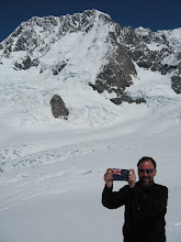
but having been on the peak over my right shoulder just 10 hours earlier.


Despite the unbelievable views from the train I just could not stop myself from falling asleep after 16 hours of hard climbing and hiking. I went to the Tourist Information Center and was helped by a young guy whose sister has just married a Kiwi. He made a couple of calls and found me a cheap hotel room close by and within the hour I had showered, eaten, and was asleep.


The next morning I paid a visit to the excellent Matterhorn Museum, built underground right in the heart of Zermatt.


The Matterhorn Museum, built to resemble the mountain.

One of their featured exhibits is the infamous rope that broke between Edward Whymper and four of his party after the first successful summit of the Matterhorn on July 13, 1865.


Probably the most famous broken rope in mountaineering.


But they also had an interesting exhibit on Dufour and the peak that now bears his name.


Museum exhibit showing where I'd just been.

Seeing this exhibit really brought home the accomplishment of the past couple of days. Just a week after Mt. Blanc I had climbed the second highest, and far more technical, peak in the Alps. I had enjoyed great weather, had my confidence restored, and felt I probably climbed at my very best. You never know who will come into your life and when – but I am very thankful for meeting Karl. He was an exceptionally nice, kind, patient, and above all, skilled mountain guide. I hope we climb together again my friend.