Ok – today we start with a quiz (wow – I feel like I'm back at work).
Can you name the country this car is from? (I know it is a Subaru made in Japan – I was meaning where is it registered?).
I hope no one said Florida!
Alright then, what country has this as their national flag?
This is the ruler (Prince) from one of the oldest nobel families who has unmatched constitutial powers in modern Europe as both monarch and head of the government of what country?
This country did not grant women the right to vote until 1984 (that is not a typo – 1984!). By the way, New Zealand was 1893 and 1920 in the United States.
This is the only country in the world named after the people who purchased it.
This country generates considerable income from the sale of postage stamps – but yet they do not have their own currency (nor do they use the Euro).
This is one of only two double-landlocked countries (i.e., the country is landlocked and so is every country it has a border with). Ten bonus points if you can name the other country.
This country is Europe's fourth-smallest? (The Vatican, Monaco, and San Marino are all smaller).
Hopefully by now you have answered – Liechtenstein. (
Fürstentum Liechtenstein is its correct name – hence the country code of FL found on cars, maps, etc., although they use 'li' as their internet TDL).
I crossed into this little country from Swizterland at its south-west corner near the castle dominated city of Balzers. Only 25 kms (15.5 miles) long by 12 km (7.5 miles) wide at its broadest point and 160 square-kilometers (62 square-miles), making it just slightly larger that Manhatten. Yet, it feels much smaller as two-thirds is mountainous with a thin plain alongside the Rhine River marking the Swiss boader. It also shares a mostly mountainous 37 km long border with Austria. The highest point of Liechtenstein is Grauspitz, and I made my way directly towards its base.

At 2,599 meters (8,529 feet) above sea level this country has one of the lowest highest points in the Alps. Yet, it is regarded as among the hardest to reach. Unlike some European counties I have visited (Germany) that have a gondala taking you directly to the summit restaurant. Or Belgium that is marked with a multitude of hiking trails leading to the highest point. Or France and Switzerland, major alpine mountains but everyone in the country knows of the highest point and you can easily find a guide and follow well-established climbing routes to get there. Not so Liechtenstein. A search on the Internet confirmed what I was finding – there are no trails, few people know exactly where it is, and if you get close, there is seriously difficult rock climbing and scrambling involved.
Not be deterred I headed to the ski resort town of Malbun (the only ski area in the country) where it appeared from what I had read online that people had made it to Grauspitz by taking the chairlift to the top and then following the ridge to the highpoint. It was an overcast Sunday morning (September 13
th) as I loaded gear into my pack and paid 13 CHf (Liechtenstein uses the Swiss franc as their official currency) for a return ride to the top of the Sareis chairlift at 2,003 meters. Judging from the cars at the base station (elevation of 1,600 meters) I am guessing about 50 other folks had done the same, although probably not all headed for the highpoint.
Into the mist but it soon cleared as I made my way on good tracks towards the first peak.
I came across an amusing sign which I think was suggesting that high heel shoes would not be a good idea.
No kidding! - Just as well I decided to wear hiking boots today.
I made my way along the ridge, passing lots of folks out hiking who all said something similar to me. Not speaking German I took it to be along the lines of: "you must be fit; we are huffing and puffing our way up these steep rocky sections and you just came flying by". There again they could have been telling me I smelt bad – I'll never know. I said
'danke' (thanks) and carried on my way, passing over the peaks of Spitz then Augstenberg at 2,359 meters. Like almost all well-defined peaks in Europe I've seen so far it had a large cross marking the highest point.
Almost at the summit of Augstenberg at 2,359 meters.
Leaving most folks to their lunch I carried on now dropping elevation to reach an alpine hut called Pfälzerhütte-Bettlerjoch at 2,111 meters.
Hut in the mist - note the small van parked outside.
Pfälzerhütte-Bettlerjoch at 2,111 meters.
I passed the hut and carried on with the track getting a lot steeper as it paralled the border with Austria. Growing up in an island nation I aways find it facintating, and still a little weird, that you can have a foot in two countries.
Austria on the left and Liechtenstein on the right.
Getting closer, I think,.....I hope.
After an hour from the hut I reached a major peak just as the weather really closed in. It was Naafkopf with a brand new huge wooden cross that looked like it had just been installed. I reset my altimeter on my watch at the hut but it was recording way low by the time I reached the summit of Naafkopf at 2,570. This can only mean one thing – a drop in barametoric pressure caused by an incoming weather change. I'd already walked a long way and the peak of Grauspitz looked to be about another 1-2 hours away along the ridge. I began to down climb along the ridge as there was no trail beyound Naafkopf. There were piles of stone (cairns) making the easiest route, but it was surprising sporty in a few places. Then the weather began to get worse. I looked at the next section and saw pitions (metal spikes driven into cracks in the rocks for attaching climbing ropes) and thought it was a little too sporty to attempt. One slip and an accident would mean I'd forever be telling people where Liechtenstein is located. Actually, climbing solo and unroped would mean you guys would be the ones forever telling people where Liechtenstein is located.

Summit of Naafkopf at 2,570.
One of the things I love about climbing is it teaches me lessons I can apply in all other facets of my life. Learning when to push through difficulties to reach a goal is a good lesson, but so too is knowing when to turnaround.
Time to turn around –
The ridge I'd down-climbed looked a lot worse as I now looked back up it so I traversed a steep scree slope (no problem for a Canterbury boy raised on greywacky scree fields) and made it back to the hut.
Looking up the ridge I've just down-climbed towards the summit of Naafkopf –
no thank you for climbing back up this so I traversed the scree slopes on the left.
I bought an ice cold Coke and took a rest at the hut (these alpine huts with their selection of beer, wine, softdrinks, and meals made to order never cease to amaze me. You can see in the earlier photo that this one gets supplied by a little four-wheel drive van that uses the narrow trails to reach the hut. A federally designated US Wilderness Area this is not!). The young woman working there spoke decent enough English for me to learn that the route from Naafkopf to Grausptiz is "extremely difficult, if not impossible, and should only be attempted by great rock climbers with gear" she said. An alternative route lead up from a valley that was served by a steep track dropping down from the hut. Knowing I'd miss the last chairlift ride back down I took this approach but did not really see any feasible way of gaining the slopes of Grauspitz so instead I began the long slog back to the car. I passed a couple of farms, one with an incredible square stone walled field. I shudder to think how long it must have taken to built this.

Stone wall - amazing amount of work to build.
Then back to the ski area passing miles of wooden structures on the steep slopes. I'm guessing these are used to break up avalanches to prevent them hitting the top station of the chairlift below.
Avalanche control - my hike began at the top of the ridge on the horizon.
Almost back to the car and an amusing sign pointing back to towards the hut noting a place called Täli-Höhe (Probably not pronouced Tally-ho – but funny to me all the same).
Reaching Malbun I decided to stay the night in one of the several local hotels. I was pretty tired but had enjoyed a fabulous day of hiking in some truly spectular scenery. I slept well that night and woke to find it had snowed over night. This was the first snow of the season and it heralds that summer is over and winter getting ever closer. I also thought it ended any thoughts about a second attempt on Grauspitz, but…..
I headed down the hill the next morning kind of feeling like I needed a low-key day. First was Triesenberg, a small town perched on a terrace above the Rhine Valley. I visited the Post Office to buy stamps for postcards and enjoyed learning about the locals from a series of interpreatative panels in an adjoining museum. Aparently in the 13
th century a German-speaking tribe called the
Valais emigrated across Europe and settled in small groups in many places, including Triesenberg (I also discovered that they settled in Vals, Switzerland, where the amazing thermal pools were; hence the name of the village – Vals). Their decendents in Liechtenstein still speak their own distinct dialect of German. On down the hill to the capital city called Vaduz. It has a population of just over 5,000 (the entire country population of 35,163 would comfortably fit inside the new University of Minnesota football stadium).
Given that Europe is now without borders (only Turkey and Russia require a visa and border crossing) you no longer end up with a wonderful collection of stamps in your passport. But for 3.00 CHf you can get a Liechtenstein passport stamp at the Tourist Office. After doing this, and engaging in a little debating with myself, I decided to take a 45 minute tour of the city on this silly looking little train.
Choo-choo through Vaduz - complete with Liechtenstein polka soundtrack,
the CD of which the driver tried to sell at each stop.
But it was interesting and I'm glad I did. I got some great views of Schloss Vaduz (Vaduz Castle) that looms over the city. It is closed to the public as it is still the private home of Reigning Prince Hans-Adam II von und zu Liechtenstein (to use his full name and title). In 1342 the county of Vaduz was formed and in 1712 it is purchased by Prince Johann Adam Andreas Liechtenstein from impoverished German nobels looking to raise a little cash. Just seven years later in 1719 the county gets bumped up to the level of an Imperial Principality within the Holy Roman Empire. In 1806 it attains soverignty status through admission to the Rhine Confederation and becomes fully independent in 1866. The same year Liechtenstein goes to war for the last time. None of its 80 soliders were killed, in fact, 81 returned including a new Italian 'friend'. The military was abolished two years later. In 1924 Liechtenstein enters into a Customs Treaty with Switzerland that includes the introduction of the Swiss franc as the official currency. In 1938 with Nazi Germany's takeover of Austria the ruling Prince of Liechtenstein leaves his traditional family home in Vienna and becomes the first monarch of his dynasty to live in their own country. During the war Liechtenstein, like neighbour Switzerland, remains neutral. The current ruler, Hans-Adam II, ascended the throne on his father death in 1989. The following year Liechtenstein became a member of the United Nations. In 2004 the eldest son of Hans-Adam II, Hereditary Prince Alois (born 11 June 1968) was given sovereign rights and appointed Royal Representative with all of the offical duties as ruler, but his Dad retains the status of Chief of the State.

Schloss Vaduz (Vaduz Castle).
The train tour then passed the small four hectares (10 acres) that make up the
Princely wine vineyard. Apparently wine from here is world famous with the main grape cultivated being the Blauburgunder. Although is exported around the world, the Prince keeps enough so that on National Day (15
th of August) the entire population are invited to the castle on the one day it is open for a glass of wine.
Princely wine vineyard.
But wine is not the mainstay of the economy. Liechtenstein, it turns out, has a very interesting and I would suggest, somewhat unique national economy. The manufacuturing/production sector provides 43% of the jobs which is a considerably higher percentage than most other European countries (and the US for that matter). The jobs are mainly in small companies with less than 50 employees (in fact there are only 18 firms in the nation that employee more than 250). The manufactuing sector mostly focuses on highly specialized market niches in electrical machinery, vechicle components, and dental technology (which is a fancy way of saying that Liechtenstein is the world's larger exporter of false teeth). Their top three export countries, in order, are Switzerland, Germany, and the USA. The manufacturing sector contributes 39% of the nations economic activity which is followed in second place by the financial services industry. It seemed as though every third building was a bank (which is not too far from the truth). Like the Swiss, Liechtenstein has a highly developed banking and finance sector which is internationally attractive for investors due to low tax rates. The largest bank, LGT, is partly owned by the Princely Family.
Another unique aspect of the economy is that 48% of the people who work in Liechtenstein are cross-border communters (roughly divided into equal portions of Swiss and Austrians with a much smaller 4.3% coming from other European nations). This also has an interesting impact on national statistics as such a large portion of the Gross Domestic Product (GDP) is dervived from non-citizens. Therefore, Liechtenstein is one of the few countries that does not produce annual GDP per capita figures as these would be so misleading when comparing to other nations.
If you are wondering how do I know all this fascinating/useless information? [I'll let you select the most apporiate word there]. Well I picked up a free little booklet from the Tourist Information Center called
Liechtenstein in Figures 2009 published by the governement statistics department. A wealth of information including:
- There were 365 marriages in Liechtenstein in 2007 (one for every day of the year – how about that!).
- A total of 115 men and 112 women died during the same year. Of these 75 were due to heart attack, 5 to accidents, and 1 to 'digestive organ failure', what ever that is.
- The population of 35,163 is divided into 13,325 households. Of these 4,656 are two parent with children; 2,978 are couples without children; 926 are single parents with children; and 145 are single adults living with their parents. Kind of sad if you knew the government knew that you were still living at home with Mom and Dad.
- There are 24,368 cars in the country making it 693 cars for every 1,000 inhabitants. These cars were involved in 420 accidents, of which 116 resulted in injuries. Yet, for the 6th year in a row, Liechtenstein reported no road traffic fatalities.
- The nations 12 Post Offices delivered 17, 825, 000 letters in 2007.
- There are 956 teachers comprised of 715 from within the country and 317 from other countries who commute in each day for their work. Some 76 Liechtensteiners are teachers who commute out to work in other countries (you think they could get together to stop all this commuting huh?)
- Only 1% of the labor force is engaged in agriculture but that accounts for 22% of total land area. Cattle (of which there were 6,037 cows in 2007) contribute almost half of the gross agriculture return - mostly from the production of dairy products. There were 3,683 sheep representing a 10% increase in numbers of the past five years.
Wow – this government collects data on everything. I find it kind of facinating in a bizarre sort of way. But enough facts and figures and I'll get back to the travel report.
After the tour I went looking for a place to stay and ended up at the Youth Hostel – a sprawling pink building located halfway between Vaduz and the countries largest city, of just 5,700, Schaan. I got caught up on my laundry and enjoyed a comfortable and cheap nights sleep. The weather forcast was for continued overcast skies with rain. But I awoke to a crisp frosty morning with bright blue skies. I decided to have one more attempt on that highpoint. I took my computer down to the reception and had the helpful woman at reception translate a few web pages in German on hiking to Grauspitz. Previously all my reconisance had been limited to English language webpages. It appears that there are two unmarked routes; a long climb from the Swiss side, and an even longer approach from Liechtenstein heading south using the next valley south and west from Malbun. The instructions from the Swiss side were confusing and the success rate seemed about 50% of those trying. The most recent success (summit on August 20
th) was posted by someone using the southern approach (called the Steg Valley) leaving only the briefest description but a couple of good photos of their route.
So, with some bread, cheese, and chocalate bought I was off to the beautiful lakeside village of Steg. I parked the car and walked up a dirt road into an amazing valley surrounded on all sides by towering peaks 1,000 meters above me.
Leaving Steg.
After an hour I got my first look of the ring of peaks – including Naafkopf,
on the left, that I'd climbed two days earlier..
Just as well the weather turned bad Sunday – that ridge looks terrible.
The snow up high was a little concerning but it didn't look that deep. The trail climbed graduadually, then more steeply, until at 1,738 meters there was no more trail. Having memorized the photos to the best of my ability I took off up the slopes at the head of the valley. I surprised quite a few marmots (chunky rodents related to squirrels) before they could dart back down their burrows.
Greeted by the marmots.
I steadily gained altitude and got quite close to a large herd of chamois (a member of the antelope family). These amazing animals are incredibly sure-footed as they graze on the steep rocky slopes and high peaks. They can jump 4 meters (13 feet) from one thin ledge straight up to another. This animal was somewhat thoughtlessly introduced into the alpine regions of the South Island of New Zealand for hunting. Although they are quite rare and tend to live the most remote parts of the Southern Alps, especially in Aoraki/Mt. Cook National Park. Having never seen them in New Zealand it was fabulous to see such a large herd in their native habitat.
Chamois
I was using my map and compass skills heading on a bearing to hit the ridge that the Internet posting suggested as the easiest route to take to reach a peak called Schwartzhorn.
Heading up the upper valley – aiming for the ridge that will take me to Schwartzhorn – hopefully.
The magnificent view down the valley with the lake at Steg looking very small.
I finally made the ridge and things once again got a little sporty.
This time I had the weather with me. Also, the snow was perfect. In places where I didn't need it to be it wasn't leaving perfect handhold on the rock. On the steep sections between the rock bluffs there was snow and I was abe to kick decent steeps. A couple of dodgy clumps of grass handholds needed in parts though. As I climbed higher I finally got my first look at Grauspitz which had been hidden behind Schwartzhorn, and my heart sank as the ridge between the two peaks appeared unclimbable (at least within my safety parameters).
My first look at Grauspitz and "the ridge". Schwartzhorn on left and Grauspitz third peak from the left.
I decided to push on to get to Schwartzhorn and reassess the situation. I found the going increasingly easy and was welcomed to the top by the Virgin Mary and her baby along with the traditional cross.
Reaching the top of Schwartzhorn.
Liechtenstein is a devoutly Catholic country, far more so than any of her neighbours. In fact, 80% of the population report to being practicing Catholics. Maybe gaining a little too much devine inspiration from the top of Schwartzhorn I decided to take a look at the ridge towards Grauspitz. My rules were simple, if I had a bad feeling then turn around; if it looks tricky to climb back up, then don't climb down; and above all, if you don't trust yourself and the situation, then get out. But the words of my climbing buddy Seth were ringing in my ears "A fall here would be bad – so don't fall!" But this was one of those days when everything comes together. It was steep for sure, but within my comfort level. Every valley, peak, meadow, stream, etc, no matter how small, seemed to have a name on my map – but not this ridge. I thought long and hard for a good German sounding name and came up with "Hairy von Scary Ridge".

Looking back up the worst part of Hairy von Scary Ridge towards Schwartzhorn.
Just like the top section of the previous ridge, things got progressively easier, although the wind began to howl. In no time I was atop Grauspitz – what a wonderful feeling.
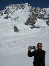
On top of Liechtenstein: Grauspitz at 2,599 meters.
From the summit of Grauspitz looking back to Schwartzhorn, Naaafkopf, and the Austrian Alps stretching off in the distance.
Like many highpoints there was a summit register. A book kept inside a water-tight tin. I noted the book had been started in 1992 and only a couple of dozen pages were filled. I added my name noting I was just the 22
nd (and probably the last) person for the year.
Looking back down the Schwartzhorn ridge I climbed up and into the Steg Valley – can you see the lake and car?
The view to the west – almost all of Liechtenstein and the Rhine Valley.
The climb back to Schwartzhorn was nowhere bad as I expected – it looks worse than it was, mostly.
Then I decided to take a chance and look for a faster route down as the wind was really blowing stronger by the minute. My gut hunch was perfect and I followed animal trails along the ridge until I reached a saddle then their tracks dropped into the head of the valley I needed to descend. The long knee jarring hike out really commenced from there – but all went well and I totally enjoyed every minute of just being in this magnificent alpine scenery. I hadn't seen a single person all day but meet a farmer out rounding up his cows. He spoke German only but I pointed to the peaks and said "Grauspitz" and raised my hands above my head. He pointed and said "Nein, Schwartzhorn". "Ja, Schwartzhorn und Grauspitz" was my reply. I received a "Sehr gut" (very good) and a warm handshake which was a wonderful moment not hindered by our inability to converse in each others language.
I got back to the car exactly nine hours after leaving. Finally got around to eating the lunch I carried all the way to the top but it was too windy to stop. I drove back into Vaduz where I decided to stay a second night at the Youth Hostel. The next morning, with slightly sore legs I headed back to Balzers, photographed the castle which was built in the 13
th century. It is now owned by the state and it is only opened when being used for concerts. Must be a magical setting for listening to music I would think.
Castle in Balzers
I now turned east and within a mile was at the Swiss border and out of this wonderful little country.
So all in all a very successful time was had in Liechtenstein. I enjoyed learning of the history of this somewhat unique monarchy and her more recent economic success. But mostly I loved being in the mountains with my two days of hiking – the summit of the highpoint was really just the icing on the cake. I found much of Swtizerland almost overrun with climbers and especially hikers. Many of the alpine meadows are covered in litter (and disgustingly much of it is toilet paper) and the tracks/trails are wide, well-maintained, and busy. Liechtenstein has much smaller but still ruggered mountains that only her few local citizens seem to appreciate. The slogan for Liechtenstein Tourism (the government tourism marketing and promotion department) is "Princely Moments". I certainally had mine.
PS – the only other double landlocked country is Uzbekistan.