
As the Cold War between East and West escalated Austria built a secret network of bunkers, military fortifications, and gun barrages. They were meant to save the small and neutral Alpine Republic from attack and the much anticipated marching through of the Soviets on their way west. This museum was one of these military installations and the only one now open to the public.

Entrance to the museum.

Entrance to the bunker and tunnels.
Twice the complex went on full alert with all guns loaded for anticipated war (during 1968 with the Prague Uprising and then 1991 with the Civil War in neighboring Yugoslavia). The museum is essentially the entire complex with an elaborate system of tunnels leading to four massive tank turrets as well as various other anti-aircraft gun positions, heavy artillery, and tanks in strategic firing positions to cover the cross border road. In addition there were separate power generation systems, command and control bunkers, and living accommodations – all underground. I had the place to myself and walked through the maze of tunnels surprised to find that the military just walked out – there were newspapers in the barracks, stacks of tinned food in the storehouse, and all the equipment for running the operation left in place. The woman running the place said that locals had no idea that the complex was here or that it was as vast until it was decommissioned in 2005.

The woman running the museum asked if I would like to see a documentary from the local Austrian TV station of the war in neighboring Slovenia, although it was in German. She made us both a cup of coffee then sat next to me and proceeded to translate the entire 45 minute film. I am so glad she did as I learned so much which helped put my visit to Slovenia into a much richer context. Somewhat amusingly, the music for the opening of the film (which showed the most graphic images that were to follow) was set to a piece of music by the French electronic music pioneer, Jean Michel Jarre called Oxygene Part 2 (remembered by most New Zealanders and Australians as the music from the 1981 soundtrack to the WWI movie Gallipoli, starting a novice actor by the name of Mel Gibson. I wonder if the local producer of this war film knew that? Or perhaps this music just goes well with war!). The movie traced events over a two week time period, starting on the 25th of June 1991. On that day Slovenia pulled out of the Yugoslav Federation after years of growing frustration at being the most prosperous of the republics in Yugoslavia but often overlooked in spending or outright threatened by policies from the government in Belgrade. Just two days later the Serbian dominated Yugoslav Army streamed into Slovenia but meet heavy resistance from the local defense force, police, and even armed citizens. As the video showed, Austria was a little surprised by the outbreak of war on her border and ordered its Army to mobilize to protect her own people and lands. The video showed some amusing scenes as young conscripted soldiers were hurriedly painting Austria flags on their tanks and armored vehicles to avoid confusion with the Slovenian and Yugoslav armies. Some of video was horrific, fighting just across a river or over a line painted in the road separating Austria and Slovenia. One telling segment sticks out in my mind. Firstly, Yugoslavia ordered all Austria forces to move back five kilometers from the border. In somewhat of a gusty call on live television, the Austria Minister of Defense refused saying the Austria people needed to see their army was there and ready to protect. Then Yugoslavia asked for a brief ceasefire so both sides could evacuate their wounded. The film showed Slovenian fighters and locals alike running with the injured on homemade stretchers. Meanwhile, a Yugoslav army helicopter arrived with huge red crosses painted on the side. As the local Austria film crew reported from their vantage point across the border, an enormous amount of ammunition was taken off the helicopter and no wounded were loaded before it departed. The Slovenian's fought hard and after 10 days the European Union brokered a peace deal. The war claimed the lives of just 66 Slovenians. Meanwhile, the Yugoslavia army turned their attention to the other breakaway republic, and a terrible bloody war was waged against Croatia in which 100,000 were killed.

Austrian tank at the Bunker Museum.
Living in New Zealand, and now the US, I don't think I appreciate peace enough nor realize how war is truly horrific. The scale of the defenses of the bunker complex and the fact that the place was operational until 2005 was frightening to me. It brought the Cold War and the Slovenia War of Independence into a new and more graphic reality for me. I left the museum and within one minute of driving I was at the Austria/Slovenia border with its recently deserted border crossing stations. It seems funny to just slow down to 40kms and drive out of one country and into another.
Yet, the huge duty-free shop just across the border was still open and I bought a large amount of very cheap chocolate. Then almost instantly into wonderful Slovenian landscapes with famous toplarji hayracks.

These are almost like an emblem for the nation and are an important element in the culture and folk architecture. Apparently they are used to dry hay by capturing the wind while being protected from the frequent summer rain storms that are generated by the mountains. I didn't really have a destination in mind but rolled into the first place I came to: the ski resort town of Kranjska Gora. Visiting the Tourist Information Center trying to get details on climbing the country's highest peak, I saw a poster on the wall. I asked the lady; "Where is that as I want to go." She replied; It's Bled – 45 minutes drive from here."
I don't remember where or when but I do know I'd seen that incredible view before. Perhaps my friend Jeff has a photo of this place in one of his amazing slide shows from his global wanderings, or from my sister Rose who loved this place, or perhaps it is in a book of 100 places to see before you die, or,….who knows. But I do know I'd seen the place on that poster and knew I wanted to go and see it for myself.

Bled – beautiful lake with a castle on the left and historic church on a forested island
all surrounded by impressive mountains.

It is hard to describe your first (and second, third, etc) impressions of Bled. Perhaps the closest I can come up with is "almost too idyllic to be true". The town of Bled is defined by an incredible little lake (just 2 kms long and 1.4 wide wide). A medieval castle sits high atop a bluff on the north end and in the middle of the lake is Bled Island (Blejskiotok), the only natural island in Slovenia. The island has several buildings, the main one being the Pilgrimage Church of the Assumption of Mary (built in the 15th century).

At the other end of the lack is the castle; first mentioned in 1004, which makes it one of the oldest in Slovenia. The oldest part of the castle is the tower. In the Middle Ages more towers were built and the fortifications were improved. The buildings are arranged around two courtyards and include a chapel built in the 16th century, and renovated around 1700.
I had a wonderfully lazy day sitting by the lake and wandering about the town. I went to the Tourist Information Center, a couple of sporting shops, and one climbing store and got terribly confusing information on hiking and climbing to the summit of nearby Trglav Mountain. Essentially, the message was you need to hire a guide as the route is difficult to find and dangerous. But this did not seem to match with what I recall reading on the Internet. I found a little hiking book of popular trails in the mountains (written by a Scottish guy) and sat down by the lake reading it while the sun slowly set behind the mountains I hoped to climb.


I've seen some incredible sunsets in my time – but this was really special. I will forever remember the setting sun in Bled.
In my Lonely Planet guidebook (also bought at the border crossing with my chocolate) it mentioned that "The Castle Restaurant has fabulous free views and mains for 20 Euro. It's run by Bled's catering and tourism school and staffed by its charming students."
I drove up to the castle and parked in the tour bus area (during the day you have to walk up the steep path from the lake.). I was able to do a brief 45 minute tour of the castle and its excellent little museum. Then off to the restaurant. I obviously had a trainee waiter taking my order and I asked to speak to his supervisor who was hovering nearby. Both seemed horrified at my request – I guess thinking some aspect of service was not to my liking. Instead, I explained what I do for a living and that I do research related to training in the tourism industry. The supervisor, who himself is a lecturer at the Tourism College located back in town. Our conversation was a wonderful sharing on a variety of topics related to tourism, training, and teaching. After my meal of roasted wild boar with local organic vegetables, we carried on talking for a little more and he brought the trainee back to practice his English. It transpires my student waiter was a young Serb from Belgrade on a tourism exchange training program. He told me how different tourism is in his home country and how much he had learned in his three months in Bled. I felt it said much about Slovenia that they would offer exchange programs to help the youth of a country they were at war with just 18 years ago. This evening with its excellent food served in an incredible location with a fascinating engaging conversation will be one of the many highlights from this incredible trip.
I had found a hotel with wifi (Internet connection) and spent some time that evening researching the climb. I learned a new trick. Much of my Goggle searches are for English only documents. Well this time I searched for Slovenian then used the Google translator function (the result is some very clunky and awkward language but you get the general idea). With my little hiking guide book and what I discovered online I knew I could climb this magnificent mountain on my own without a guide. I guess I stayed up too late as I had a much slower start from Bled in the morning than I planned (it was just so hard to pull myself away from such an incredibly idyllic spot). I headed back west retracing my journey of the day before by driving on a brand new EU financed motor way. I turned up the Vrata Valley passing a beautiful little church.

Then into Triglavski Narodni Park (Triglav National Park) which is a 84,000 hectare reserve (representing 4% of Slovenia's total land area) that surrounds and protects the highest mountain – Triglav.

I headed up the steep narrow little road deep into the mountains passing waterfalls, thick forest, and incredible blue streams.

I parked the car and hurriedly packed for what I thought would be a long day hike and took off. Almost immediately there was an alpine hut and adjacent little chapel.

Interestingly, camping is forbidden in this national park so your only option is to stay at the huts. This is the Aljazev Dom (Dom means hut) located at 1,015 meters above sea level in the upper part of Vrata valley, just past the road end. The first hut on this site was opened way back in 1896., but in 1909 the hut was destroyed by an avalanche. The new hut was opened the next year and it still stands today. It has 150 beds and is open from beginning of May till the end of October.
Off up the trail into a forest that reminded me a great deal of the beech forests of the east coast of New Zealand. Then an incredible monument with a huge piton and carabineer dedicated to the partisans who died fighting the Germans in these mountains during the Second World War.

The Partisans Memorial near the base of Triglav.
A little information on the mountain I was setting off to climb. The website "SummitPost" where I get much of my information for these climbs, notes: "Triglav is not just a mountain, Triglav is a kingdom", wrote Julius Kugy, famous explorer of Julian Alps, in his book Aus dem Leben eines Bergsteiger (From the Life of the Mountaineer). He couldn't be more right. The silhouette of Slovenia's sacred mountain, the nation's highest peak proudly stands on the national flag as part of national coat of arms. Its image in on the Slovenian 50 Euro cent coin with Triglav depicted below the constellation of Cancer (Slovenia achieved independence under the zodiac sign of Cancer) with a semi-circle above that having two lines of text, the outer one reading SLOVENIJA (Slovenia) between the twelve stars and the inner one reading "Oj Triglav moj dom" (O Triglav, My Home) from the patriotic song written by Jakob Aljaž, a Slovene priest, composer, and mountaineer. The first president of Slovenia, Milan Kucan, said that it is the obligation of every Slovenian to climb Triglav once at least. Triglav does not only have an appeal for the people of Slovenia as it is regarded as an international giant for rock climbers and mountaineers. Despite the lower height compared to many other European peaks, it attracts thousands of people each year from all over the world on their own pilgrimage to Triglav's kingdom. "
At 2,864 meters (9,396 ft) Triglav is the highest mountain in Slovenia (and in all of the former Yugoslavia) and the highest peak of the Julian Alps. The origin of the name Triglav is still not completely clear. Triglav means three heads (tri glave). The early Slav's believed that the mountain was the home of a three-headed deity who ruled the sky, the earth, and the underworld. Although the most often provided rationale for the name comes from the profile (seen only from the south) that shows three peaks/heads (on the left is Rjavec (2,568 m), in the middle is main summit, Triglav (2,864 m) and on the right is Mali Triglav (2,72 5m, small Triglav), which is actually just a shoulder of the main peak. The first recorded ascent of Triglav was made on 26 August 1778, by Luka Korošec, Matija Kos, Štefan Rožič, and Lovrenc Willomitzer making it one of earliest big European mountains to be climbed.

Leaving the Partisans' Monument I then headed up, straight up, one of the steepest trails I've ever ascended. It was called Tominškov Pot (or in English the Tominskova Route) being named for Dr. Fran Tominšek who was President of the Slovenian Mountaineering Society. He pioneered the route in 1903 and today it is regarded as being the second most difficult of the 20 well established routes to the summit. A sign near the base said 5 hours to the summit. It was hot and hard going up through the trees but the views down the valley were incredible.


Then the trail essentially ended and was replaced by wire cables and metal foot pegs sticking out from the rock. This is called a via ferreta (although each country has a name for them in their own language but I'm going with the most common and original Italian0. Originally developed in Italy they can now be found throughout the mountains of Europe with a few sprinkled elsewhere around the world. During World War I and more specifically, along the Austro-Hungarian/Italian front in the Dolomite Mountains troops established routes with ropes, fixed wire cable lines, and ladders to ease movement across the steep faces. Indeed via ferreta originally meant iron road. After the war many of the via farrata were restored with steel cables replacing ropes and iron ladders and metal rungs (called stemples) anchored into the rock have taken the place of the flimsy wooden structures used by the troops. Some via farrata are tourist attractions in and of themselves, others just part of a trail to the high peaks. Thinking I might do some of this in France I had bought a special harness in Chamonix and now got to use it for the first time. It essentially ties into the front loop of a regular climbing harness and has two equal-length webbing loops with a snap-lock carabineer on the end. This allows a single climber, without a rope or partner, to move along and up the cables. And as long as you only move carabineer at a time, then you are always safely connected to the mountain.


The view up - miles of steep limestone to cross.

The view down across what is left of Triglav Glacier.

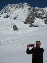
Meeting the locals.
Nearly six hours after leaving the car I reached the Kredarica Ridge – the final push of two hours to the summit begins here. But it had taken a lot longer than the signs suggested so I checked into the massive Triglavski Dom na Kredarici (translates as Triglav Hut on Kredarica) at 2,515 meters. Luckily I found they had room for me for the night.

Triglavski Dom na Kredarici is largest and highest hut in Slovenia. It is placed just above the pass between the top of Kredarica Ridge (2,540m) and the base of the summit ridge of Triglav. It was built by Slovenian Mountaineering Society in 1896 behind the idea of Jakob Aljaz. Since then it has been enlarged many times. The hut today was built in 1984 and in 1992 a chapel was erected next to the hut. Later a meteorological station was built and this is operated year round. The hut has 300 beds, 5 dining rooms, and is full (often overcrowded) most weekends during the brief two month climbing season (August/September). I joined the huge crowd and ate an over-priced totally unsatisfying meal of goulash followed by gloppy macaroni and cheese (although it appeared the cheese was absent!). Being on my own, surrounded by beer drinking rapidly getting drunk Slovenian's who appeared not to know how to speak English, I headed downstairs and thanks to a iPod in my ears managed a great night's sleep.
I awoke to a terrible wet cloudy morning and accompanying breakfast equal to the dour surroundings and meteorological conditions. I almost pride myself on not only my ability to consume terrible coffee but also to recount the truly horrific cups of this seemingly easy to prepare beverage I've ingested over the years. Well, the mountain hut high on Triglav will now stand alone in all its glory as being the location for the absolutely worst coffee – ever! It was then I made a couple of interesting discoveries. The locals were drinking chai not coffee (with chai meaning tea - nothing like what you get if you order chai if a coffee shop but rather a pre-made strong super sweet fruit tea). Not only was it good but it was 1/4 the price of the toxic by-product being passed off as coffee. The second discovery was a group of English speaking folks who I joined as we waited for the weather to clear. The Anglo-speaking group of the Vienna Chapter Austrian Mountaineering Club could not have been more geographically diverse with members from Germany, the Czech Republic, England, Ireland, and the United States (all working in Austria – mostly for multinational corporations or government embassies).
After too many cups of chai and only a marginal improvement in the weather we headed up the summit path route into the mist and clouds. All the guidebooks and signs in the hut warn of rock fall on this section. I was glad I was wearing my helmet but aghast that over half those climbing were not. As previously mentioned, there are about 20 routes to the summit – most are long but gentle hikes from the south and west, unlike the steep path I took up the north face. So, we joined a great number of day hikers which caused delays at the sections of fixed cables and via ferreta. It was no where near as steep as yesterday do I didn't bother with harness, in fact, very few did.

Heading up from the hit into the clouds.


In just a few minutes more of continuing to following the sharp ridge line – the summit suddenly came into view with its famous little shelter right on the highest spot.
Aljazev Stolp on top of Triglav is located at 2,864 meters (9,396 feet). The idea for a shelter on the summit was first proposed by Jakob Aljaz, the priest from Dovje-Mojstrana village near the base of the mountain, and well-known explorer of Julian Alps. Jakob (born 1845-died 1927) played a huge role in the development of climbing in this range and in helping to establish the myth and mystic surrounding climbing this mountain. He arrived for his assignment in Dovje-Mojstrana in 1889, a year after German mountaineers built a hut (which still stands) to provide access to the mountain. The Germans next developed plans to build a massive viewpoint on the summit and a cog railway to provide an easy way to the top in the hopes of developing tourism. Aljaz was outraged and decided to purchase the summit area from the communal village owners in Mojstrana to show the Germans that Triglav is a Slovenia mountain. This act essentially prevented the type of development found on many European alpine peaks. Then in 1895 he decided to privately fund the placing of a small round structure on the summit of Triglav to act as a symbol, viewpoint, and small shelter. . He designed a building based on a church pillar, just 1,90m high and 1,25m in diameter to accommodate 4 to 5 people. Apparently, as the story goes, six stong men from the village each made trips to the summit with 20kg sections of the tower. On August 7th, Anton Belec and four assistants put it together in 5 hours and erected 1m high wall around it to make it more resistant to fierce winds. Since then it is stood proudly on the summit of Triglav and has since become a National symbol and in 1990 it was declared a cultural and historical monument.
Arriving at the summit was one of the most amazing experiences I've had in the mountains. I was tired as it was slog up the ridge line and the English speakers from Vienna are all very fit (with one exception and we left him to plod on up at his own pace). There were probably about 20 others there when we arrived and much cheering went up from the crowd. Others came over to shake hands and ask if we were Slovenian. It transpires that if you are you have to stick your head through the door of the Ajazev Stolp while someone else slaps your backside three times (ideally with a birch branch but obviously a length of climbing rope seemed to suffice). Then you are called a true Slovenian. There was an incredible festive, supportive, and clearly nationalistic spirit that you could not only see but feel. It was like the United Nations with climbers from the Czech Republic, Iran, Great Britain, Ireland, Serbia, Italy, Germany, Austria, US, and GB, and of course me (NZ/USA). And each time a new climber or group arrived the whole cheering, handshaking, and backside slapping began all over again. A group of young guys from Serbia arrived and they had carried two flags to the summit. I thought it was a class act when they took photos first with the Slovenia flag then their own Serbian (the colors are the same). I asked if I could borrow their Slovenia flag and have a photo I really like to remember this incredible mountain.

I left the summit and headed back to hut for a quick bottle of coke. Then on down a different trail, although not quite as steep or without quite as much via ferrata. I followed the Prag Route which follows beneath a huge towering buttress (or Prag meaning threshold in Slovenian) dropping a knee jarring 1,900 meters (6,234 feet on my journey from the summit to the valley floor.

Interesting erosion patterns on the limestone – Prag Route.


Beneath the towering Prag – which gives the route its name.

Near the base the weather cleared and I was presented with the full view of the massive North Face.

Back to the car tired, hungry, but having had a wonderful adventure. I drove into Kranjska Gora to find almost every hotel room taken with a huge international mountain bike race being held on a nearby ski resort. I tried the youth hostel – the dorms were filled but they offered me a single room in a nearby building and I have the entire place to myself.

Leaving town the next morning the jagged main ridge of the Julian Mountains rose straight up from the fields presenting a lasting image to treasure. What a wonderful discovery this little country was and what an incredible moving experience was provided to me on her special mountain. It felt like I had been given a gift from Slovenia. I have often thought during this travel that I guess (perhaps not, but maybe…) I could learn the essence of these countries I visit by reading the classic literature. Or perhaps viewing the most famous films would work equally well. Or days spent visiting the major cultural museums, art galleries, and historic buildings would no doubt shed light on the land and her peoples. Yet, I feel that travelling alone into the heart of the mountains, being fully awake and aware of the surroundings, and meeting and interacting with the others (mostly locals) there to share their mountain with you provides me deep, rich, and unique insights and experiences I'll forever treasure. My climb to Triglav and short visit to Slovenia are one such priceless gift.

Morning view of the Julian Mountains.
I headed west and shortly arrived at the border with Italy and then drove through some incredible mountainous country, partly on toll motorways and party on little winding roads. I had my iPod connected to the car radio and selected music I thought best fit the countryside. I know my friend Jeff will understand when I say that this was perfect Chris Rea driving terrain. Up over yet another steep mountain pass with the structures of the WWI front-line still clearly visible and I was back into Austria making my way to back to the glacial peaks of the Alps and the village of Kals. I'll pick up the story there in my next post.
Very surprised bout your visit to Slovenia, glad you did it. Mountains are spectacular.
ReplyDeleteI'm from Slovenia and first time for me to see those fortifications and tunnels on border with Austria.
Thanks for the photos and captions.
Now just to make a little correction there was no civil war in Yugoslavia.Slovenia had it's independence by then so Yu army was invading Slovenian sovereign soil and therefore it was an occupier. We call it independance war so do Croats, because the situation is similar but much more nationalistic, with a lot of serbs living there. The death toll was higher (15.000) but still not as high as in Bosnian atrocities (almost 50.000).
Just to let you know, otherwise a fantastic trip and posting.
vesthepes